A journey through the revitalized Grand Canal—from our book Shandong: Rivers Deep, Mountain High
“The Grand Canal represents the greatest masterpiece of hydraulic engineering in the history of mankind, because of its very ancient origins and its vast scale, along with its continuous development and its adaptation to circumstances down the ages. It provides tangible proof of human wisdom, determination and courage. It is an outstanding example of human creativity, demonstrating technical capabilities and a mastery of hydrology in a vast agricultural empire that stems directly from Ancient China.”
— From the UNESCO World Heritage Report on the Grand Canal, China
Among the historical achievements of Chinese civilization, the Grand Canal is sometimes forgotten. At a colossal 1,794 kilometers, it is the longest and oldest man-made waterway in the world. Perhaps no single innovation has had such a profound influence on Chinese civilization as this feat of engineering.
China managed to maintain a large empire at a time when most of Europe was still living in small settlements. For two-and-a-half millennia, the Grand Canal has shaped China’s culture from within. It ran from Beijing in the north to Hangzhou in the south, with ports in Tianjin. The provinces of Hebei, Shandong, Jiangsu and Zhejiang, the canal was created to improve imperial communication and to transport men and commodities across the nation, allowing the commercial hubs it graced to flourish into centers of trade and learning.
The Grand Canal was ancient China’s beating heart, and held the title of the world’s largest and most extensive civil-engineering project from the time of its construction in 468 BCE until the Industrial Revolution. Three times in its history, there have been extensive renovations and enlargements which have strengthened and increased the canal’s influence—in the Spring and Autumn period (770 – 476 BCE), the Sui dynasty (581 – 618) and the Yuan dynasty (1206 – 1368). The canal also links five mighty rivers—the Hai, Huai, Yangtze, Qiantang, and the Yellow River. The canal was awarded UNESCO World Heritage Status in 2008.
The Flow of Time
In the late 19th and early 20th century, the Yellow River flooded repeatedly, with the 1887, 1931, and 1938 floods considered the three deadliest in history, killing millions. They actually broke the Yellow River dikes, shifting the river to its current northern course. The canal was already becoming dilapidated in parts and had ceased to be a major supply line for Beijing. After 1934, the Chinese government carried out extensive renovations, including dredging and rebuilding the canal between Huaiyin and the Yangtze. Locks were installed to allow passage for medium-sized steamers, and in 1958 new works began to straighten, widen, and re-dredge the waterway with the goal of maneuvering ships of up to 600 tons along the canal. The work was completed in 1964, including a new section of 64 kilometers.
The “Shandong Eight”
Of all its great stretches, the most significant feat of engineering is in the canal’s Shandong reaches, known as the “Shandong Eight.” Running 643 kilometers through the cities of Dezhou, Liaocheng, Tai’an, Jining, and Zaozhuang, the Shandong stretch was known to be the most difficult to navigate and demanded the most complicated maintenance.
The Shandong Eight is perhaps the best showcase of the technological creativity of the traditional canal system—a key factor in its UNESCO application. The Huitong Canal project of 1289 was one example. It began north of the Jizhou Canal summit section; the canal ran downhill, fed by the Wenhe River where it joined the Weihe River at Linqing. To allow ships to traverse the sharply sloping landscape, engineer Ma Zhizhen built numerous locks, with between 200 and 400 feeder springs, to maintain consistent water levels. Remarkable features like these allowed the canal to maintain constant water traffic.
Dezhou, Linqing, Liaocheng, Jining, and Tai’erzhuang became significant trade and transport hubs after the canal’s construction. The first records of Jining date from 1271, but the city quickly gained prominence as the birthplace of Confucius and Mencius. Eventually, this engineering feat came to be known as the “Grand Canal City.” The Jining section of the canal was the very last to be completed, with the most complicated stretch being the site of the Nanwang Water Diversion Pivotal Project (南旺分水枢纽). In 1411, the Ming Emperor Yongle tasked an official named Song Li with the project. Song was advised by a farmer to build a diversionary system that included dozens of sluice gates along the main route and its auxiliary channels. These allowed the flow of water to be adjusted so that ships could control their passage. Although it took thousands of workers nearly nine years to complete, the Nanwang Water Project ultimately connected North and South China at Jining.
North Meets South: The Caoyun System
In 548, during the short-lived Sui dynasty, a major imperial project was undertaken to connect and expand the canal’s existing waterways. The outcome was the creation of a unified system of intra-provincial communication and transport; this initiated vast territorial expansion from an economic and cultural perspective, human migration between north and south, and innovations in bureaucratic institutions.
The canal allowed for an imperial monopoly on the transport and storage of grain, salt, and iron, and the creation of an efficient centralized system of taxation known as the Caoyun (漕运) system. Caoyun was the centralized transport system that levied a grain tax on agricultural land, and the canal ensured their transport was efficiently managed and regulated. In this way, the canal contributed to the fundamental link between the peasant economy, the imperial court, and the food supply to the military.
The Caoyun system was still in place up to the 20th century, a significant factor in the stability of the Chinese empire through the centuries. The Sui, and later the Tang, were able to exert a centralized authority over a vast area compared with other civilizations at the time. The canal allowed the court to communicate relatively freely with even its most distant subjects on a scale unmatched anywhere in the world until the Industrial Revolution.
By overcoming the logistical difficulties of moving tons of grain across the country, the Caoyun prompted a rapid increase in the size and importance of the public granary; at its peak, more than 424,000 tons of grain were shipped to the capital every year. It was this process that integrated North and South China into a single political-economic entity. By 608, the Grand Canal teemed with constant traffic in vast convoys, giving merchants across China access to the capital and the southern ocean.
The last major alteration came during the Yuan dynasty, when the Mongols moved the capital to Beijing to facilitate greater communication within their empire. It was the Yuan that initiated the shift along a straight north-south axis, which required the canal to cross Shandong, making an astonishing engineering feat even greater. Perhaps even more incredibly, this was achieved within the first 20 years of the Yuan takeover, by 1299.
Onward to the Future: Preserving a Living Heritage
With the political upheavals of the 20th century and the end of the Caoyun system, the Grand Canal fell into decline. Increasing urbanization, development, and a growing population resulted in many reaches becoming clogged with junk. The Linqing section, at the start of the Huitong Canal, narrowed and fell into disuse. Sections were marred by sewage outlets, and swarms of mosquitoes hovered over the surface waste. The canal was choked and filthy all the way north to Liangshan county and beyond.
Ahead of the UNESCO application, Shandong was tasked with restoring and conserving the cultural heritage of the canal. Although some individual cities had already begun the renewal, the process was centralized, and the various relevant regions were tasked with clearing, regulating, restoring, and dredging the venerable waterway.
The Conservation Plan of the Shandong Section of the Grand Canal Heritage was initiated, as well as the Measures for the Protection and Management of the Shandong Section of the Grand Canal Heritage. While some stretches in the north remain polluted and impassable, others now pulse with trade. Some sections today shift three times as much cargo as the rail links between Beijing and the Lower Yangtze region.
In 2008, the Chinese Cultural Heritage Research Academy and the Southeast University produced the Guideline of the Conservation Planning of the Grand Canal, comprising five parts: the engineering features of the canal and sites related to infrastructure; the historical towns and villages that line the canal; the structures nearby; the landscape environment; and the “intangible cultural heritage.”
How the various departments of Transportation and Water Resources Management work together will determine how the Grand Canal is preserved—and how it will flourish—in the years to come.
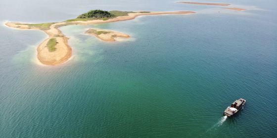
Cover image: Tai’erzhuang Canal Wetland Park, Zaozhuang
Excerpt taken from Rivers Deep, Mountain High, TWOC’s guide to Shandong. Get your copy today from our online store!


